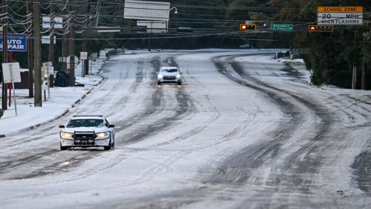
It snowed again in Florida for the second year in a row. The snow surprised residents of the western Florida Panhandle on Sunday morning when an unusually cold front brought snowfall to the area. On January 21, 2025, several of these same locations recorded up to 20 centimeters of snow, the heaviest snowfall in many areas since the late 19th century. This is something that is met with surprise, but also with concern, since it shouldn’t snow in places where it doesn’t usually.
In areas where it doesn’t usually snow, residents are often unprepared to deal with such situations
And this wasn’t an isolated incident. Snowfall was also reported in southeastern Alabama and southern Georgia. The event, unusual for the region, left between 2.5 and 5 centimeters of snow accumulation in several locations, prompting weather warnings and scenes of snow in places where this phenomenon is uncommon. Even cities like Columbus and Macon, Georgia, woke up to a blanket of white, leading authorities to issue warnings of potential traffic disruptions. As we know, in areas where it doesn’t usually snow, residents are often unprepared to deal with such situations.
Towns like Laurel Hill, DeFuniak Springs, Chipley, Marianna, Crestview, Pace, and Navarre Beach recorded thick snowflakes
The snowfall we mentioned last year set a historical precedent that is now gaining relevance again with this new winter episode. Towns like Laurel Hill, DeFuniak Springs, Chipley, Marianna, Crestview, Pace, and Navarre Beach recorded thick snowflakes, according to local media. Specifically, meteorologists and climate experts describe these two consecutive snowfalls as unusual anomalies for the area, given that snow events in Florida are typically brief and with little accumulation. This time, in some areas, official measurements showed up to five centimeters, while most reported between 2.5 and 3 centimeters or just a light dusting. Although the surfaces weren’t completely covered, the discovery of snow in a subtropical state is certainly noteworthy and causes concern.
The Florida Department of Transportation activated specialized equipment and machinery starting at midnight
Caution is paramount in these situations. In fact, the Florida Department of Transportation activated specialized equipment and machinery starting at midnight to address the potential development of ice on more than 500 bridges and critical areas of the Panhandle. It’s worth noting that while Florida has experienced snowfall throughout its history—local media report more than 80 snowfalls since the late 19th century—what is remarkable is that it has occurred in two consecutive years.
The snowfall has not caused major traffic disruptions or significant damage
According to experts, the presence of a winter air mass from the northern United States, combined with moisture from the Gulf of Mexico, created the necessary conditions for precipitation to turn into snow in these areas. Consequently, sub-zero temperatures and an increased risk of ice prompted heightened monitoring and cautionary recommendations for drivers. Although, given the circumstances surrounding this phenomenon, the snowfall has not caused major traffic disruptions or significant damage, local authorities are urging caution. The potential risk of icy patches on critical sections of the roads could pose a serious hazard, so drivers are advised to proceed with extreme caution.
Other years with similar amounts of snow in these areas include 2018 and 1989
In short, this isn’t an isolated incident, and it’s important to consider the circumstances that triggered it. Looking back at history, other years with similar amounts of snow in these areas include 2018 and 1989, with smaller amounts in 1958 and earlier decades that left only fleeting traces and a few postcard-perfect images. So, if someone sends you a picture of snow in Florida, this time it’s not due to artificial intelligence or chatGPT.

